I got this idea from a book - someone had done the same with a map of the States...
...and I have been working on it for a while. In fact, this is my second attempt, as I made a nasty mess in Northamptonshire on the first one!
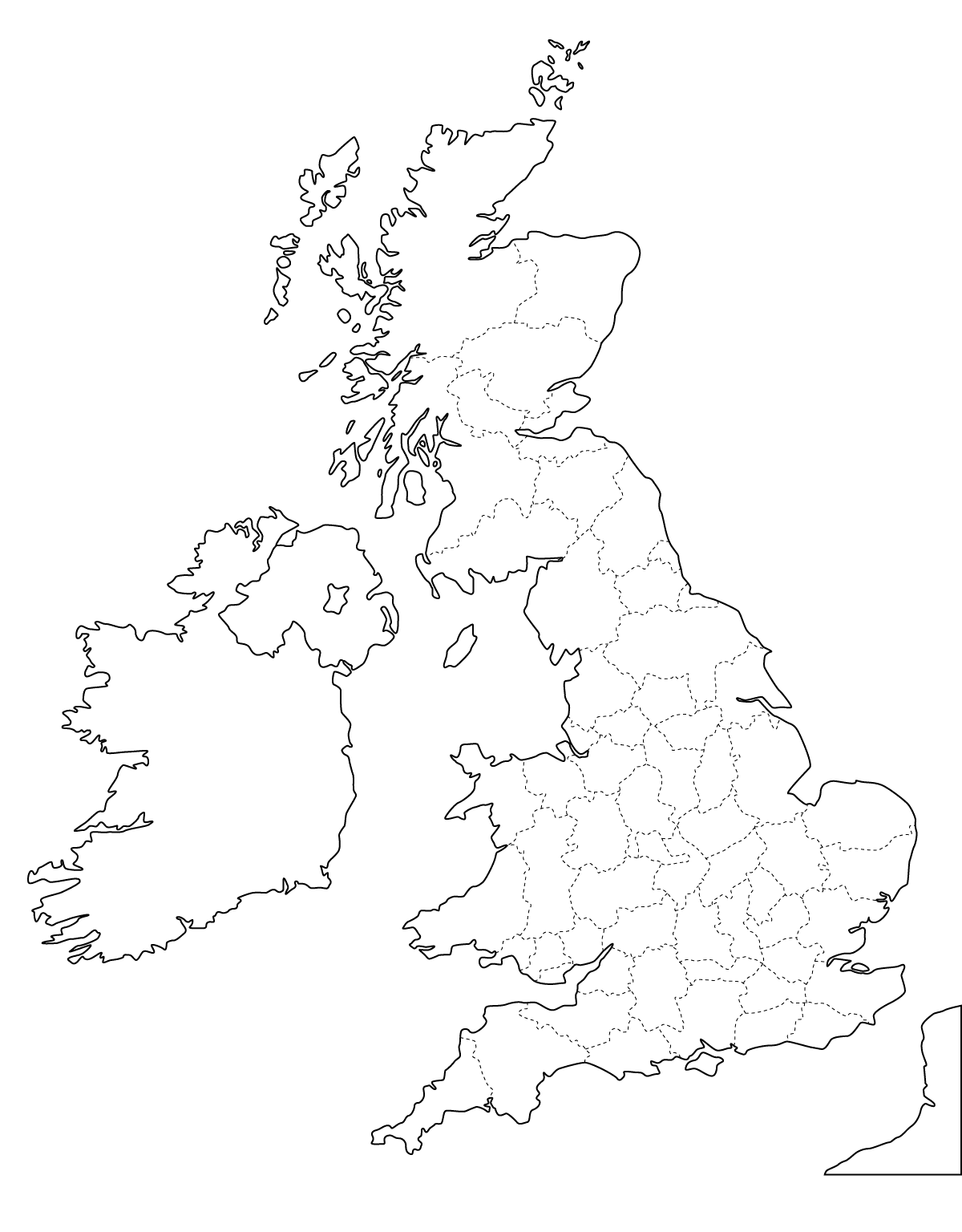
I know my outlines of the counties are not entirely accurate, but I tried to keep to the original as much as possible.
(I am sincerely hoping that the original county outlines found on line are accurate - things have changed muchly since I left the UK in 1962! - Well, if not, hopefully someone can direct me to an accurate county outline and I will start all over again!)
(I am sincerely hoping that the original county outlines found on line are accurate - things have changed muchly since I left the UK in 1962! - Well, if not, hopefully someone can direct me to an accurate county outline and I will start all over again!)
For my UK bloggers, please forgive if my representation of your county leaves something to be desired :{
Because it holds very special memories for me, East Yorkshire (or, as we used to say, the East Riding of Yorkshire) is a heart tangle.
If you would like to try this for yourself, you can find the outline map here
The map with the county names inserted is here

If you click on it, you will see it more clearly.
My original plan was to personalize each county with a drawing of its flag - that would have been lovely. But so many of the flags are very detailed and complicated - I could never have accomplished that task. If you would like to rise to the challenge, there is a listing of each British flag for counties, regions and cities here. You will have to arrow down through a myriad of flags, but you will get to them eventually. It is quite an interesting page, actually.
Anyway, good luck if you are going to attempt this! And when you are done, be sure to post it so that we can all see the end result (perhaps this time next year!)
Anyway, good luck if you are going to attempt this! And when you are done, be sure to post it so that we can all see the end result (perhaps this time next year!)
Now it's time to do Canada-in-a-Tangle!


I love it! I love your comment "I made a nasty mess in Northamptonshire". I remember doing that once - but I divorced him :)
ReplyDeleteHa! I knew that you or snafu would pick up on that one, AJ - too funny!
DeleteOh AJ!!! I chuckled out loud at your comment!
ReplyDeleteThis is a great idea, Kay and beautifully done. I'm gradually catching up after all our adventures. I'm way behind in my Inchies, but hope to do an intensive Inchie catching up soon.
Glad you're back, ChrisJ - did you see my last inchie?
DeleteAn interesting idea and I imagine it would be a real challenge, even if it was done on a six foot by four foot piece of paper. I don't think you need worry about the exactness of the borders, the patterns take over and it is difficult to see where they should be on the scale you have to post.
ReplyDeleteHi Kathy - it still is very much the East Riding of Yorkshire! x
ReplyDeleteI noticed a common mistake. In Northern Ireland you have included all of Ulster. This is not the case as some of Ulster went back to the Republic of Ireland. You shouldn't have included Donegal, Sligo, Leitrim, Cavan, Monaghan of Louth. None the less still impressed at the effort.
ReplyDeleteThanks so much, Darragh, for the correction...something to remember. I am writing this over 8 years later, during Covid...just happened to be looking for something else at the time!
Delete